

Before arriving at Pearson Reef (2014-9-25; n=6 sites: AUPE123-128), we spent a day (2014-9-24) surveying six sites of an unnamed reef (#96: AU96-117-122). On 2014-9-26, we surveyed six sites at Siddons Reef (AUSD129-134), though I have misplaced those photos.
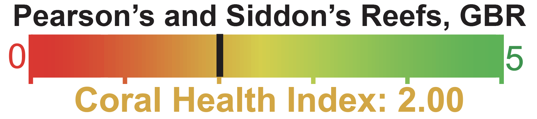
Pearson’s Reef coral cover=52±13%
Siddon’s Reef coral cover=52±7%

“11-096” corresponds to unnamed reef 96 (to the south of the map)
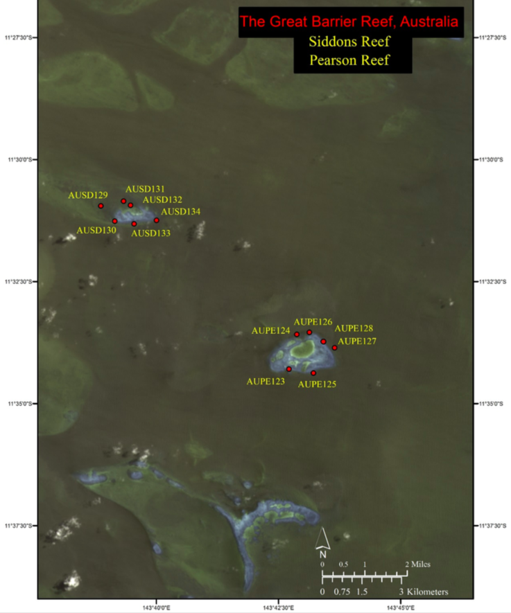
High-resolution habitat maps are curiously NOT posted on the Living Oceans Foundation’s world reef map website, something I need to look into.
AU96-117 (2014-09-24)-lost pics
AU96-119 (2014-09-24)


AU96-121 (2014-09-24)


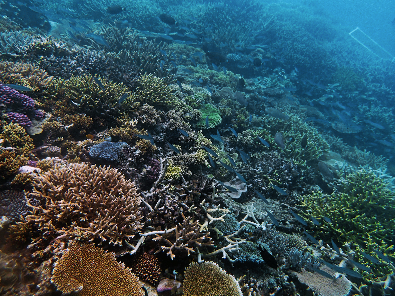
AUPE123 (2014-09-25)


AUPE125 (2014-09-25)


AUPE127 (2014-09-25)


AUSD129, AUSD131, AUSD133 (2014-09-26)-lost photos